When Boundaries Defy Geography: A Critique of the Kargil Hill Council Delimitation Draft
By Dr. Gulzar Hussain, Ph.D History, Presidency University
VOL News Desk/ The reorganization of the administrative map of Ladakh has proceeded at a pace few residents could have anticipated. A Union Territory that for decades comprised two districts now has eight, and within this restructuring the Hill Council of the newly demarcated Kargil district has been expanded from twelve constituencies to twenty-one. In principle, more constituencies should bring representatives closer to the people. In practice, however, the value of such expansion depends entirely on how the boundaries are drawn — and it is here, respectfully submitted, that the draft prepared for Kargil gives rise to serious and legitimate concern.
The concern is not a matter of preference or politics; it is grounded in the statute itself. The draft was not prepared without legal guidance. Section 9(4) of the Ladakh Autonomous Hill Development Council (Amendment) Regulation, 2026 sets out what must guide the application. It says that, in deciding the extent of each constituency, “as far as practicable, due regard shall be given to the contiguity, compactness of area, the boundaries of panchayats and the desirability of securing a comparable population in each constituency within every Council, keeping in view the area and the seasonal inaccessibility.” Also as per the notification dated on 23 October 2026 by state Election commission Ladakh in their notices states under Rule 3 of the Election Rules, 2026, constituencies must be built from panchayat halqas and municipal wards, with none divided. The Commission must also consider contiguity, panchayat boundaries, comparable population, and seasonal inaccessibility which were also stated by the LAHDC (Amendment) Regulation, 2026.
Read closely, this provision asks for more than it first seems. It names five separate considerations. The first is contiguity, so that a constituency is one connected piece of land. The second is compactness, so that it is not stretched over unreasonable distances. The third is respect for panchayat boundaries, so that existing local governments are not split without cause. The fourth is a comparable population across constituencies, so that every vote carries similar weight. The fifth is attention to area and seasonal inaccessibility, which recognises that in the high mountains a short distance on a map can be a long, and sometimes impossible, journey in winter. These are not decorative words. They are the legislature’s own instructions on how constituencies should be shaped.
The phrase “as far as practicable” gives the delimiting authority some room for judgment. No fair critic would deny that perfect contiguity or equal population is rarely possible in mountain country. But the phrase is meant for real difficulty, not as permission to ignore the rules. When the authority departs from the criteria, we would expect a clear reason, such as a settlement too small to stand alone, a natural barrier that forces an unusual boundary, or a population limit that leaves no other choice. A departure that is neither explained nor necessary is not an act of discretion. It is a failure to follow the law.
Evidence of Non-Compliance
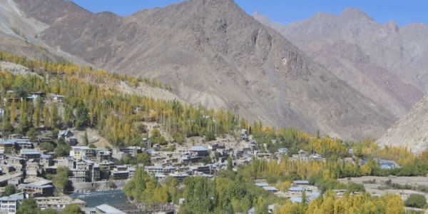
The treatment of Kargil town shows most clearly how far the draft has moved from these principles. The town was earlier a single constituency made up of Goma Kargil, Lankor, Pishu, Dass, Daythang, Kako, Shilikchay, Balti Bazar, Chanchik, Thanskangrong and nearby localities. It was a clear community of interest. Its people use the same markets, the same civic services and the same roads, and share the same daily concerns. A representative elected from it could reasonably be expected to know the whole area and speak for it.
The draft has upset this arrangement in a way that is hard to defend. One section of Goma Kargil has been separated and placed with the Poyen constituency, even though the two areas do not share a border. Anyone who knows the ground will tell you that many settlements lie between them, including Pishu, Abagrong, Balti Bazar, Dass, Daythang and Main Bazar. Poyen can be reached only after passing through all of these. The two areas are not neighbours in any sense. They are not next to each other, they do not form a compact unit, and they have no natural link. Even if the draft joins them on paper, it is hard to see how they can be joined in terms of development.
The effects of such a plan are not just theoretical. A councillor elected from two distant areas must divide time, attention and development funds between communities that have little in common except a line drawn by the authority. A project that matters to one part, whether a road, a water scheme or a school, may mean nothing to the other. Meanwhile, the people in the separated section of Goma Kargil are now represented in a constituency whose centre lies elsewhere, while the area where they actually live and work has been split. The idea that these two parts can grow together is supported neither by geography nor by common sense.
The grouping of Kharul and Biathang with Baroo raises the same concern, and in a sharper form. These localities lie at opposite ends of the district. Biathang and Kharul sit at one end of Kargil, and Baroo at the other. No reasonable reading of the map allows them to be treated as parts of one compact constituency. The distance between them is large, the terrain is difficult, and no shared interest explains why they were paired. This arrangement goes directly against the rules of contiguity and compactness, and it ignores the Act’s clear mention of area and seasonal inaccessibility.
These examples are not isolated. Other areas that lie far apart have also been combined into single constituencies. That pattern matters. One mistake might be an oversight, and a few awkward boundaries might be excused as the price of balancing population. But a repeated pattern of distant, unconnected areas being joined points to a problem in the method itself. The problem may lie in the criteria used, the information relied upon, or the care taken to check the result against the ground. It also raises an uncomfortable question: were the statutory criteria treated as binding at all, or were they only mentioned in passing?
Implications for Representation and Governance
These defects matter far beyond the map. The constituency is the basic link between a citizen and the body that governs development in their area. When it makes sense, the link is strong. Voters know their representative, the representative knows the area, and accountability follows naturally. When it does not, every part of that chain weakens. Voters in the far corners of a stretched constituency find it hard to reach their representative. The representative, in turn, finds it hard to understand, let alone serve, areas with different needs and character. Development planning depends on a clear picture of what an area needs, and without it planning becomes guesswork and competing claims.
Public trust is also at risk. Residents have reacted with confusion and growing anger, and many see the draft as a sign of administrative carelessness. That view may be harsh, but it is not unreasonable. When boundaries cannot be explained by any visible principle, people draw their own conclusions about why they were drawn. In a small and close district, where people know every stretch of ground, oddities such as combining Goma Kargil and Poyen, or the link between Kharul, Biathang and Baroo, are noticed at once and discussed widely. A process that looks careless, or worse, arbitrary, harms confidence in the very institutions the reorganisation was meant to strengthen.
Finally, there is the question of what happens once elections are held. Delimitation is one of the most lasting decisions a public authority can make. Once election results come from a set of boundaries, those boundaries gain a life of their own, and reopening them becomes costly in both political and administrative terms. This is why defects must be fixed at the draft stage, when correction is still possible and cheap. Errors that remain will shape representation, and through it the sharing of resources, for years to come.
Delimitation is not a mechanical task of dividing a number across a map. It decides how political voice is shared, how well governance reaches citizens, and how fairly the gains of development are spread. For this reason, the law lays down the principles that must guide it, and for the Kargil Hill Council those principles are clearly stated in Section 9(4) of the LAHDC (Amendment) Regulation, 2026. A draft that overlooks contiguity, compactness and accessibility, in terrain as demanding as Kargil’s, falls short of the standard set by the Council’s own law.
The remedy is neither complicated nor unreasonable. The authorities should review the draft with local stakeholders, including residents, panchayat representatives and political parties, who know the ground far better than any map. They should publish the reasons behind their boundary choices, so that any departure from the legal criteria is explained rather than left to speculation. And they should revise the draft to meet Section 9(4), starting with the most obvious problems described here. The people of Kargil are not asking for perfection. They are asking that the law be applied as written, and that those who represent them be elected from areas that make sense. This is a modest demand, and a draft that cannot meet it deserves to be sent back to the drawing board.
The opinions expressed in this article are those of the author and do not necessarily reflect the views of the When Boundaries Defy Geography: A Critique of the Kargil Hill Council Delimitation Draft
1 Comments
Leave a Reply
Also the villages of Yokma Karbu, Sandow and Lamsoo are added on Stakchey Khangral constituency which is around 30 kms far from them. It is a total blunder.